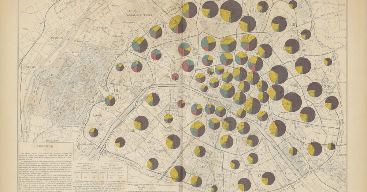
Georeference Any Map in QGIS: Scanned Books to Leaflet TIFFs, No Projection Math
Millions of QGIS users georeference maps yearly, turning book scans into GPS-ready layers. No calculus needed – just points and a click.
⚡ Key Takeaways
Worth sharing?
Get the best Developer Tools stories of the week in your inbox — no noise, no spam.
Originally reported by dev.to
Related Stories

Open Source
LRU::Cache: The C-Powered Speed Demon Rescuing Perl's Caching Woes
Open Source
Go's G/M/P Scheduler Through a Human Lens: Days, Months, and the Real Cost of Switching

Open Source
Rust's Naive Port of python-dateutil Delivers 94x Speedups — No Code Changes Needed
Open Source